Exploring Off The Rim
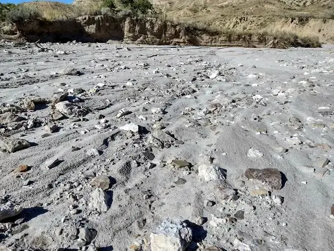
- Off The Rim: A Treasure Trove for Rock Enthusiasts
Hey, amazing souls! 😊 Guess what? I’ve stumbled upon this incredibly accessible geologic paradise, and I’m bursting to share all the deets with you! So, here’s the scoop: A break in the weather gifted me the perfect opportunity to take my drone for a spin. The Cedar Rim, Dishpan Butte, and Beaver Rim area is THE place to capture some seriously jaw-dropping footage. Now, keep in mind, I’m a bit of a drone novice, so I need plenty of space to spread my wings. LOL!
After my recent escapade on Burma Road, I remembered this accessible chalcedony spot from my exploration geologist days. It was perfect for a little collecting session, especially with my adventurous 92-year-old mother in tow. So, I gathered her up, and off we went for an afternoon adventure.
But alas, flying the drone was a no-go. It was too windy up there on the Rim. So, we set off to collect some chalcedony below instead.
Rocks
Those old exploration roads I once knew like the back of my hand? Long gone. Now, they’re just impassable, erosional remnants of the past. I took a newer, passable road leading to an abandoned oil well on a dry creek bed. One of my earliest memories involves crossing this creek when the only access to this whole region was a seasonal dirt trail. Picture this: my father holding me in his arms, trying to show me a bobcat on a rock outcrop just across the creek bed. I was too young to know what a bobcat was and never saw it, but I remember that outcrop. Now, it’s just a blip on an all-weather, paved road blasting through—a prompt for fond memories.
So, what could possibly be left to collect there now?
We got out, and with no wind, it was the perfect place for my mother. I was thinking drone; she was all about the rocks. I do believe I inherited the geology gene from her!
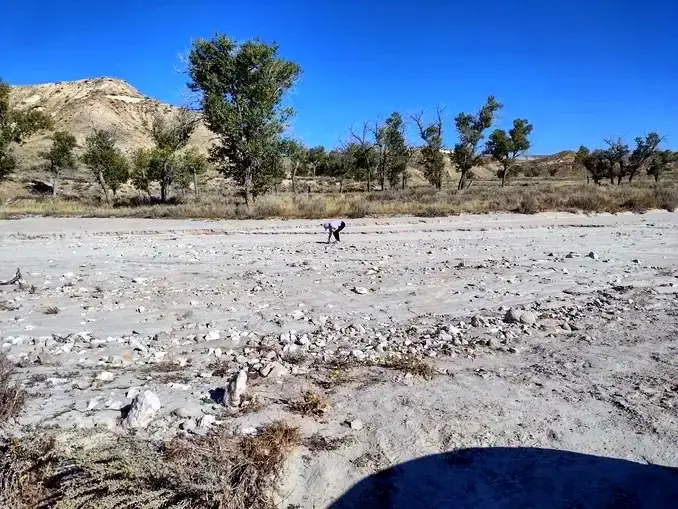
- What’s She Struggling With?
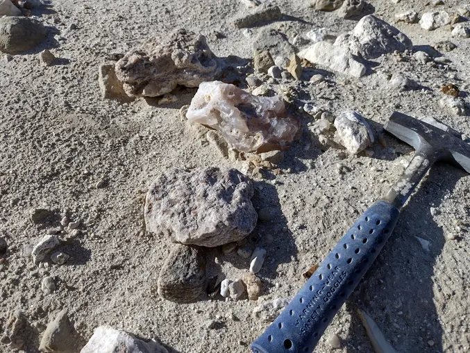
- Then… Omg! A Creekbed with Large Yellowstone River Type Agate and More!
They were abundant, and the quality was something I hadn’t seen since my childhood. This year’s unseasonal spring flash floods uncovered treasures buried under a couple of feet of sand.
After collecting enough, I thought about the source. There’s lots of geologic structure here, but like every geologist, my first look is uphill. And there’s lots of uphill here! It was almost the golden hour, and uphill was a great place to fly the drone.
So, uphill I went with the drone in tow. Along the way, I found several rocks with the same agate and chalcedony as in the creek bed, but these had druzy vugs of botryoidal chalcedony, opal, and some matrix attached. I’d seen this stuff before—a long time ago.
Back in elementary school, a girl brought it to class and wowed us all. I begged her to tell me where she found it, swearing I’d ride my bicycle there! But she refused, and I was totally jealous. Turns out, I had ridden my bicycle to within a few miles of it!
And I’d seen buckets of it being worked into cabochons by local lapidaries. At the time, I thought it was the famous Montana agate from the Yellowstone River, 200 miles north of here. Not so, but I bet it was sold as such. LOL!
Flying the Drone
So, despite my somewhat outdated aviation experience, I launched the drone. As a novice, I fumbled with controls that were foreign to my pilot muscle memory. Add to that a small, dim screen displaying flight parameters and flashing warnings I could barely see in daylight, let alone understand. It was exciting, but stressful.
Forget about any kind of flight planning or cinematography—it was just a matter of turning on the cameras, flying it without crashing, and bringing it home safely.
Here’s what I saw, through drone eyes, a thousand feet above the draw—a panorama from left to right.
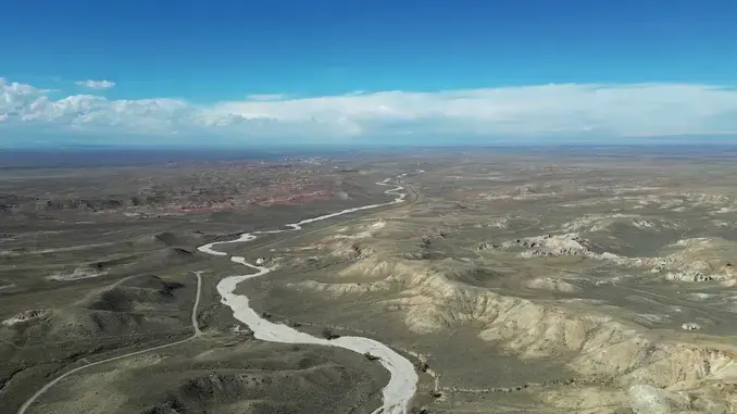
- Down the Creek
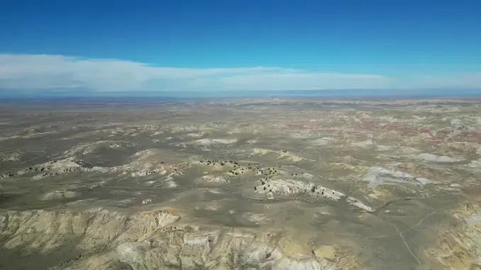
- Anticlines, Geologic Structure
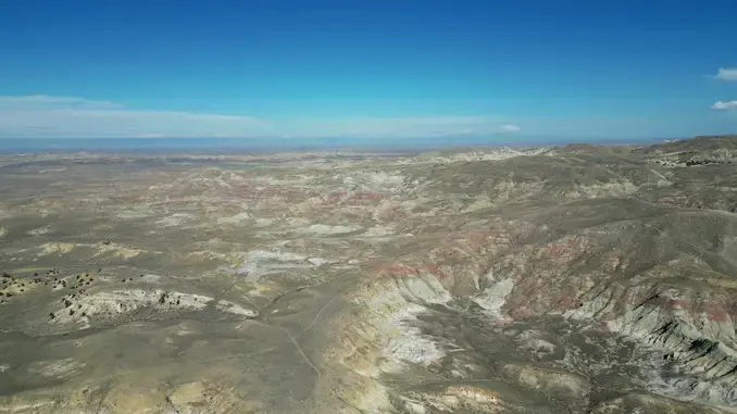
- Badlands and No Motorized Access
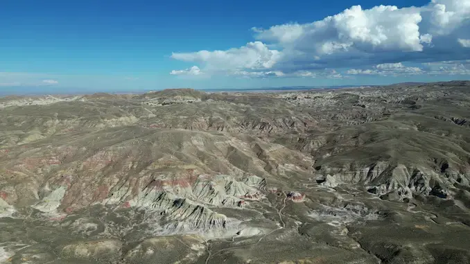
- Badlands, Solitude, Adventure
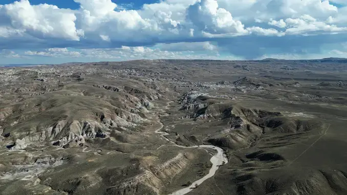
- Up the Creek with Beaver Rim on the Horizon. No Road Access At All!
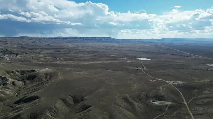
- Beaver Rim, Cedar Rim, and Dishpan Butte on the Horizon. The Only Road Leads Away from This Area!
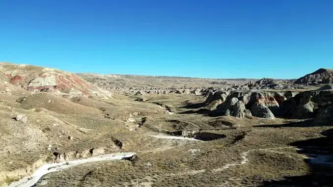
- At 250’ Above the Creek: Is It a Geologist’s Paradise Lost? Sure Has Adventure Potential!
But Do They Glow?
So, back at home, I washed them off and waited for dark.
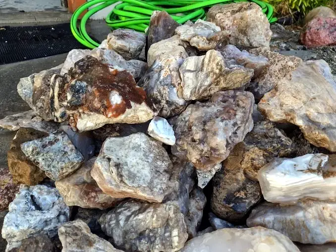
- Shiny, Clean, Nice in Natural Light
And… glow they do!
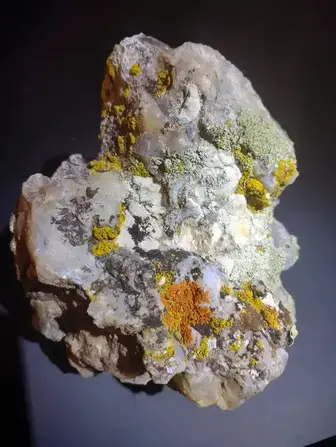
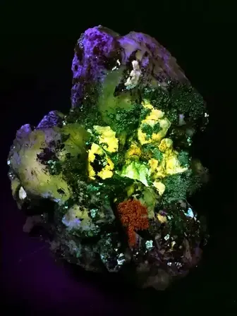
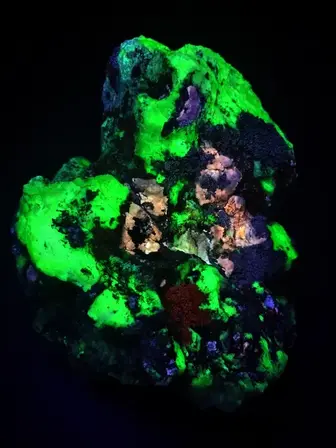
- Rock Specimen in Natural, Mid-Wave, and Short-Wave Ultraviolet Light
These are the best fluorescent rocks I’ve ever found in Wyoming! I packed up and headed back out there for a night of collecting, but that’s another story.
These specimens are very near the in situ source for all of the best tertiary silicates I’ve found scattered across over 100 miles of alluvium. This is the source of the Burma Road chalcedony, so I’ll be back when spring weather breaks. 👧
Cheers, D 🪨🔥
